Do not hesitate to give us a call. We team is here to talk to you.
+264 81 8211 521
info@safariworldtours.com
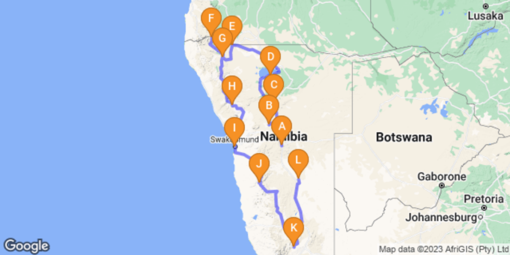
This journey begins in Windhoek, Namibia’s relaxed capital, blending modern city life with historic architecture and surrounding khomas highlands. Traveling north, Khan River Lodge offers a peaceful bush stop near Wilhelmstal, with wildlife, open savanna and big skies. The route continues to Otjiwarongo, a central hub close to conservation projects and gateway to the north. From there, Etosha National Park delivers world-class game viewing, vast salt pans and iconic waterholes teeming with wildlife. Heading west, Ruacana introduces the Kunene River and hydroelectric schemes, before reaching the dramatic Epupa Falls, where palm trees, waterfalls and Himba villages create one of Namibia’s most scenic landscapes. The road south leads to Opuwo, cultural heartland of the Himba people, offering insight into traditional lifestyles. Далее, Twyfelfontein showcases ancient rock engravings, desert-adapted wildlife and striking geological formations. The Atlantic coast welcomes you in Swakopmund, a lively seaside town with German heritage, adventure activities and cooler ocean air. Turning inland, Sesriem provides access to the towering red dunes of Sossusvlei and Deadvlei in the Namib Desert. The route continues south to the awe-inspiring Fish River Canyon, one of the largest canyons in the world, carved into rugged rock landscapes. The journey ends in the Kalahari, where red dunes, camelthorn trees and wide-open spaces offer a tranquil finale to a diverse Namibian adventure.
• Upon Booking a 10% non-refundable Deposit is required to Confirm booking of Tour/Activity/
Accommodation or Car Rental.
• Remaining 90% should be paid not later than 30 Days Prior to Departure.
• If tour is within 40 days or less prior to booking full payment is required.
• Your deposit can either be made through a Bank Transfer, Online Debit or Credit Card Payment.
After your arrival at the Hosea Kutako International Airport approx. 45 km east of Windhoek, you will be welcomed by the car rental company and taken to Windhoek where you will take over your vehicle with all the necessary instructions and information. Afterwards you will drive to your accommodation where you are able to freshen up and rest. In the afternoon you will be picked up by your guide for an interesting Windhoek city tour, during which you will get to know historical buildings and the township of Katutura. In the evening you can go out for a relaxing dinner. We can recommend Joe’s Beerhouse, Cape Town Fish Market or The Stellenbosch.
Included activities
• Historical visits
Optional activities
• You can visit Alte Feste an old fort and the 1896 Christuskirche Christ Church.
Overnight: Arebbusch Travel Lodge
Omaruru is a small, historic town in the Erongo Region of central Namibia, lying roughly northeast of Wilhelmstal (about 75 km by road) along the C36/C33 route that leads toward central
and northern parts of the country. It sits on the banks of the usually dry Omaruru River and is
surrounded by semi-arid savanna and game-farm landscapes. The town enjoys more greenery
than the surrounding plains because of underground water reserves in the riverbed area.
Included activities
• Afternoon game drive
Overnight: Khan river Lodge


You will continue your journey and depart to Otjiwarongo an affluent town with a suburban feel and numerous attractions. The town is known for its excellent conservation projects, which include several parks protecting large wild cats
Included activities
• A visit to the Cheetah Conservation Fund, and the Crocodile Ranch
Optional activities
• Hiking, guided nature walks, and safaris
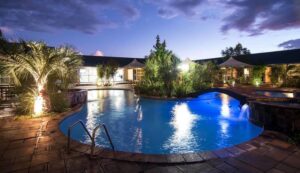
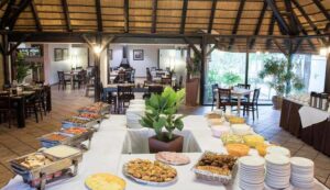
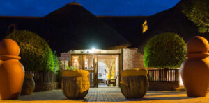
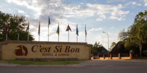
Overnight: C’est si Bon Hotel, Otjiwarongo
You will depart to Etosha National Park and stay 2 nights. The park’s main characteristic is a salt pan so large it can be seen from space. Yet there is abundant wildlife that congregates around the waterholes, giving you almost guaranteed game sightings. At the same time, Etosha National Park is one of the most accessible game reserves in Namibia and Southern Africa, the concentration of big games around the waterholes makes game viewing incredibly rewarding. You might not even have to leave your rest camp to see lions, elephants, rhino and any number of antelope and zebra quenching their thirst
Included activities
Game drive
Overnight: Halali Resort
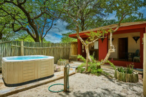
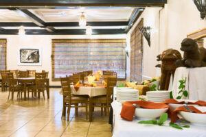
Clients have breakfast, today will be a full day of safari game viewing allowing plenty of opportunities for good sightings and spectacular photographs. After breakfast at the lodge, we go out on our morning game drive.
Included activities
Full day game drive
Overnight: Halali Resort
Have breakfast, leave the wilderness and wildlife of Etosha National Park behind us and depart to
Ruacana where you will be staying for 2 nights.
Included activities
• Visit the Ruacana Falls
Overnight: Ruacana Eha Lodge
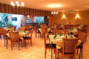
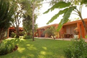
We will get up early and go on a hike to Ruacana Falls. The dramatic Ruacana Falls are 120m and 700m wide in full flood and are sometimes referred to as one of the most spectacular sights on the continent. After our hike to the falls, we start our expedition more in-depth into the Kunene Region, exploring the real life of the Himba Tribe.
Included activities
Hiking
Overnight: Ruacana Eha Lodge
Basis
FB: Full Board – Dinner, Bed, Breakfast and Lunch
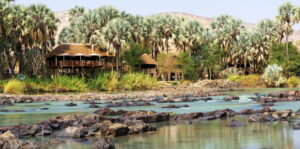
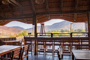
Have an early breakfast and depart to Epupa Falls, today you have the day to enjoy the natural attractions around Epupa Falls
Included activities
Guided Visit to a Himba Village, Sundowner drive/walk
Optional activities
Guided Hikes, white water rafting and kayaking and Bird Watching Trip by Boat
Overnight: Epupa Falls Lodge
Basis
FB: Full Board – Dinner, Bed, Breakfast and Lunch
The surrounding landscape is characterised by low-lying hills, and vast dry desert plains inhabited by a wealth of desert-adapted wildlife. It serves as the central hub for the Himba culture. The town provides a perfect base for visitors wishing to explore the Kaokoland area and visit the local villages of the itinerant Himba people.
Included activities
Visit Hoarusib River, Hiking
Optional activities
Visit the Ovahimba Living Museum
Overnight: Opuwo Country Lodge
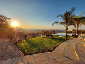
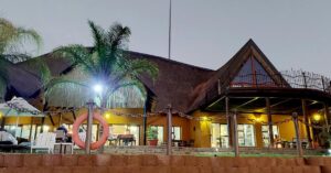
You depart to Twyfelfontein the world Heritage Site with famous rock engravings on the search of the elusive desert-adapted elephants. As you continue deeper into the Damaraland, the landscape becomes increasingly dramatic. You should reach your accommodation. Enjoy another breath-taking sunset with a refreshing drink.
Included activities
See the Petrified Forest or marvel at the Organ Pipes and Vingerklip
Guided Hiking Trails.
Twyfelfontein rock engravings
Geological rock formations
Overnight: Twyfelfontein Country Lodge
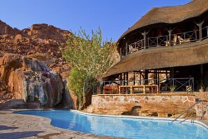
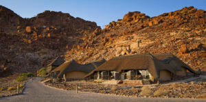
This morning we leave Twyfelfontein and make our way to the cooler coastal town of Swakopmund by the Atlantic Ocean. This town resembles a small German town with its architectural buildings, palm-lined streets, seaside promenades, restaurants, cafes, art galleries and museums. We spend the next 2 nights in Swakopmund enjoying the various different activities on offer.
Activities Included
2-Hour Quad Biking, Sand-Boarding
Overnight: Hotel Pension A La Mer
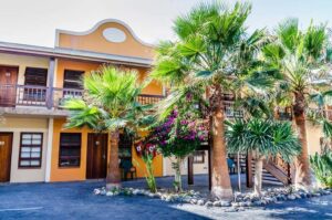
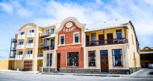
Today you have a free day to take on some of Swakopmunds activities, if you fancy something different, visit the local beaches, eat at the local restaurants and enjoy the town’s vibrant cafe culture.
Optional activities
Living Dunes Experience from Swakopmund; Scenic Desert Tour, Sky diving,
set horse riding and paragliding
Overnight: Hotel Pension A La Mer
Basis
FB: Full Board – Dinner, Bed, Breakfast and Lunch
Leaving the coastal plateau, we head inland, via picturesque moon landscapes and rugged passes, pausing for a photo stop at the Tropic of Capricorn. Our accommodation for the night is under canvas in a picturesque setting, in a quaint desert camp, in the Khomas region of central Namibia.
Included activities
Enjoy the sundowner Dune Drive
Overnight: Desert Camp
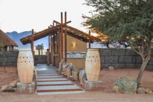
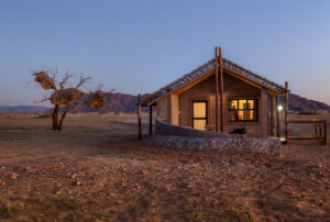
Guest will wake up and have breakfast before going into the park for Sossuvlei Excursion which includes Dune 45, Deadvlei, Hiddenvlei, and Big Daddy. The tour guide will have regular stops to let clients take pictures and have some exposure of the Dunes.
Included activities
Sossusvlei Excursion ( Deadvlei, Big Daddy, Dune 45)
Overnight: Desert Camp
Basis
FB: Full Board – Dinner, Bed, Breakfast and Lunch
Today we drive through barren landscapes and Rocky Mountains dotted with quiver trees to one of Africas natural wonders, the Fish River Canyon. This wondrous canyon is the second largest canyon in Africa being 550m deep and 161km long. We enjoy an afternoon walk along the edges admiring the deep ravines and meandering waterways.
Included activities
Hiking
Optional activities
Scenic chartered flights, nature drives and seasonal kayaking.
Overnight: Canyon Village
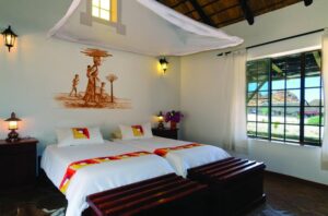
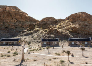
You will have breakfast and a full day to continue with the activities you did not get to do.
Overnight: Canyon Village
Overnight: Canyon Village
Basis
FB: Full Board – Dinner, Bed, Breakfast and Lunch
You will get morning Breakfast and depart to Mariental which is located close to magnificent the Hardap Dam, which is the largest reservoir in Namibia. The Hardap Irrigation Scheme has breathed life into this arid terrain, which is now fertile with farmlands covered in citrus, melons, lucerne, wine, and maize, and dotted with ostrich farms.
Included activities
Sunset Drive
Overnight: Bagatelle Kalahari Game Ranch

You will get breakfast and depart back to Windhoek
Here African lions, cheetahs and the majestic leopard rule the landscape together with different antelope species such as the large Eland and the zebra. With breathtaking game drives, one can see the endangered white rhino as well as Namibian flora and other smaller fauna.
Okapuka Ranch – located 30 km north of Windhoek, Namibia’s capital
Erindi, meaning “place of water”, is a sustainable natural wonderland. With 70,719 hectares of pristine wilderness under their care, they have undertaken an immense task to pursue conservation initiatives in the name of eco-friendly tourism, whilst empowering local communities.
The reserve is home to about 20000 animals including various rare and endangered species.
A Game Reserve, or Game Park (often called a Wildlife Park in East Africa), exists specifically for the preservation of wild animals. In these areas, wildlife like antelopes, rhinos, and giraffes are protected.
Muted coloured, lightweight clothing is best for game viewing. Game drives are generally conducted in the early morning and the late afternoon, which can be cold, especially in winter. The temperature often warms up during the day, so it is best to dress in layers and comfortable shoes.
Our suggestion for footwear would be comfortable closed-toe shoes. If you’re going on a guided walk during your game drive, we would suggest supportive shoes or hiking boots. Avoid sandals, flip-flops, or any open-toe shoes that can expose your feet to insects, dust, and dirt.
If you want you can tip your safari guide a minimum of 200 per person per day.
A national park is government-owned and managed and a private game reserve is just that, privately owned and managed. Both national and private reserves still adhere to the same principles, rules and regulations of conservation and wildlife protection.
As animals stick to their own schedules, the best game viewing is either at first light or around dusk.
Between 1904 and 1907 the white settlement of Otjiwarongo evolved from a German military station established to fight the rebellious Herero. Boer trekkers returning from Angola settled in the vicinity in 1933, and the settlement of Otjiwarongo became a municipality in 1939.
Otjiwarongo is known for some of its popular attractions, which include: Cheetah Conservation Fund. Mahango Game Reserve. Waterberg National Park.
Otjiwarongo (Otjiherero: “pleasant place” or “place where fat cattle graze”) is a city of 28,000 inhabitants (2011) in the Otjozondjupa Region of Namibia.
Climate. Otjiwarongo has a semi-arid climate (BSh, according to the Köppen climate classification), with hot summers and mild winters. The average annual precipitation is 457 mm (18 in).
May to August: Etosha National Park has the best weather at this time, the days are not as hot, and nights can be chilly, so it’s essential to bring a couple of warm layers. July to September: This is the best time for visiting the park, as you’ll see plenty of animals flocking to the limited water supplies.
Etosha National Park is located in the Kunene region of Namibia. The name, “Etosha,” translates locally to “Great White Place.” The name of the park is derived from the Etosha pan which accounts for 23-25% of the national park area.
If your primary purpose for going on a safari is to see the majestic Big Five, Etosha National Park is a great choice, as four of the Big Five are present. Only the buffalo is absent, while lions and elephants are very commonly spotted.
Etosha is approximately 6 hours from Windhoek by road. The road is good tarmac and can quickly be reached in one day. By the Eastern route, Etosha is 553km north of Windhoek.
Etosha Village is only 2km from the Anderson Gate of Etosha National Park, Undoubtedly, you will find excellent accommodations, facilities and campsites at Etosha Village.
The park is also well designed for self-drivers. The biggest thing to work out when planning your time in Etosha is where to stay, as there’s a lot more to consider than you first think. There are effectively two experiences on offer. The in-park experience and the out of park experience; let me explain.
Etosha is indeed one of Africa’s most extraordinary game parks and the most diverse park in Namibia. Plan your visit to the park, and we recommend a minimum stay of two to three days. It is such a large park that you will need time to explore this fantastic area.
On average, the warmest months are January, September, October, November and December. Etosha National Park has dry periods in May, June, July, August and September. The coldest months are June and July. The rainiest months are January, February, March and December.
Today, there are over 260 black rhinos in the hands of 28 custodians, including both commercial farm owners and communal conservancies.
It is easy to spot a herd of elephants in the fantastic game drives over Etosha National Park, especially in Moringa and Okaukuejo waterholes in the dry seasons. If you want to see rhinos and especially the endangered black rhino, then there is no better place than Etosha.
Ruacana is a town in the Omusati Region of northern Namibia and the district capital of the Ruacana electoral constituency. It is located on the border with Angola on the river Kunene. The town is known for the picturesque Ruacana Falls nearby, and for the Ruacana Power Station
Ruacana Falls is a waterfall located in Ruacana, Omusati on the Kunene River in Northern Namibia
Ruacana was developed around the Ruacana Hydroelectric Power Station, a major underground hydroelectric plant linked to the nearby dam across the border in Angola at Calueque. The dam and pumping station were bombed in a Cuban airstrike in 1988, during the Angolan Civil War.
Ovazemba and Ovahimba people are native to the area.
4X4 ROUTES, AIR CHARTERS. Visit ANIMAL PETTING FARM, ANIMAL SANCTUARIES, ARCHERY, ART RETREATS, ASTRONOMICAL OBSERVATIONS and VISIT THE RUACANA FALLS
The falls are fored by a series of cascades that drop for about 60m over a distance of approximately 1.5 km. It even reaches a total of about 500m at one point. The falls are also known as Monte Negro Falls in Angola. The name Epupa is a word in the Herero language meaning plumes of spray created by falling water.
Located in one of the most remote points of Namibia, Epupa Falls is a real oasis for nature lovers. This waterfall on the Kunene River is one of the most important in southern Africa. Although it has a maximum drop of 20 meters (65 feet), it produces a stunning landscape full of consecutive falls between the rocks.
Epupa Falls is in Kaokoland in the remote north of the Kunene Region of northwestern Namibia.
In the local language of the Ovahimba people that live here, Epupa means “falling water” while also known as the Monte Negro falls in Angola. A column of spray can be seen and felt at the peak of its grandeur when the Kunene overflows its banks.
The name Opuwo was given by the commissioner of Ondangwa, Hugo Hahn, who came in search of land to build an office. Upon his arrival, he asked local headmen to give him land where he could build an office.
Opuwo, meaning ‘the end’ in Herero, lies in the north-western Kunene region of Namibia. It serves as the capital of the region and is known as the gateway to the magnificent Epupa Falls.
Opuwo is the capital of the Kunene Region in north-western Namibia. The town is situated about 720 km north-northwest of the capital Windhoek, and has a population of 20,000. It is the commercial hub of the Kunene Region.
Himba people are home to the area.
The water quality at Opuwo has shown that the town’s water supply is unfit for human consumption in more than half the cases tested.
Yes, there are factors beyond our control mostly with accommodations either they are fully booked and we now need to look for a substituted which means that the itinerary may change, and each tour operator reserves the right to do this. Generally, these changes are minor, and we will do our best to advice clients.
Damaraland is a desert region with less than 100 mm of rain annually, the whole area can become green and lush with grasslands during the March to May rainy season turning the whole area into a scenic highlight.
Damaraland has a harsh, semi-desert climate. Daytime temperatures can spike to well above 38°C/100°F during summer (November to April), with winter nights falling below freezing (October to April). The Wet season occurs during summer
The Himba people mainly live in the North-West part of Namibia. Please remember when you visit the tribes to show respect to them and their cultures and views. They are also changing to the environment they live in today, so do not be surprised to see them in modern clothing or occasionally clutching a cell phone! Please also be aware that whilst we endeavour to arrange walks and meetings with the tribes, they choose what and when they wish to do things, which can occasionally be out of our control.
The site forms a coherent, extensive and high-quality record of ritual practices relating to hunter-gatherer communities in this part of southern Africa over at least 2,000 years, and eloquently illustrates the links between the ritual and economic practices of hunter-gatherers.
Twyfelfontein is situated in the southern Kunene Region of Namibia, an area formerly known as Damaraland. The site lies on the banks of the Aba Huab River in the Huab valley of the Mount Etjo formation.
Their original culture was a mixture of an archaic hunter-gatherer culture and herders of cattle, goats and sheep. Due to their loose social structures the Damara were not able to defend themselves against aggressors during the colonization of Namibia.
The top stops along the way from Windhoek to Swakopmund (with short detours) are Daan Viljoen Game Reserve, Okapuka Safari Lodge, and Gross Barmen. Other popular stops include Erongo Mountain Winery, Moon Landscape, and Bambu Wellness Boutique.
Swakopmund generally makes a more interesting place to stay, with a much better choice of restaurants, hotels and guesthouses, whilst Walvis Bay is the springboard for several super desert trips. Holidays to Namibia usually include a visit to this part of the coast.
Walking at night is not advisable and many tourists consider public transport to be unsafe; private car rental is the safest option for independent travel. Use only recognised hire car companies or official taxis.
The average cost of living in Swakopmund is $769, which is in the top 30% of the least expensive cities in the world, ranked 6480th out of 9294 in our global list and 1st out of 10 in Namibia.
The best way to get to Swakopmund is by road from Windhoek. The B2 is the main road from Windhoek, and takes 4-5 hours by car. It may seem like a long ride, but time will fly when you look out the window of your vehicle and take in the spectacular sites.
What is the nearest airport to Swakopmund? The nearest airport to Swakopmund is Walvis Bay (WVB) Airport which is 35.3 km away.
The quality of tap water in Namibia is quite good and perfectly safe to drink. Many of the lodges in the more remote areas will make use of water from a borehole which is also safe and healthy to drink.
The C28 is gravel, and the surrounding roads are best suited to high-clearance vehicles, but you won’t need a 4×4 unless you hit Bosua Pass during a serious (and rare) downpour.
The distance between Swakopmund and Walvis Bay is 31 km. The road distance is 34.7 km.
Crime Index: 47.83
Safety Index: 52.17
The name “Sossusvlei” is of mixed origin and roughly means “dead-end marsh”. Vlei is the Afrikaans word for “marsh”, while “sossus” is Nama for “no return” or “dead end”.
Standing atop one of the tallest dunes on Earth, it felt as though the sand beneath our feet stretched into infinity. With its red dunes rolling endlessly into the ocean, the Namib is the oldest desert in the world — a sea of silica stretching along Namibia’s entire Atlantic coast.
It’s fascinating shape and accessibility makes it the most photographed dune in the world. The dunes of the Namib Desert were created by sand carried by the wind from the coast of Namibia. The sand here is 5 million years old and is red in colour due to its iron oxide conten.
Dune 45 at 170 meters tall is the most well-known dune chosen to climb by those who visit the Sossusvlei area. This relatively ‘easy’ climb takes anywhere from 40 minutes to one hour to reach the top, for most people.
These dunes are the tallest in the world, in places rising above the desert floor more than 300 meters (almost 1000 feet).
Big Daddy is the tallest dune in the Sossusvlei area. This magnificent dune is situated between Sossusvlei and Deadvlei and at 325 meters it dwarfs the other dunes.
Some 900 years ago the climate dried up, and dunes cut off Dead Vlei from the river. It became too dry in Dead Vlei for the trees to even decompose. They simply scorched black in the sun, monuments to their own destruction. The trees, now over 1000 years old, form a barren forest.
The trees are estimated to be approximately 900 years old, however they have not decomposed due to the dry climate. Deadvlei is a paradise for photographers as the contrast between the pitch-black trees and bleached-white pans, and the rusty-red dunes and deep blue sky make for incredible images.
The climate is dry in Deadvlei that some trees have not decomposed, and they are somewhere around 1000 years old too.
The salt pan of Sossusvlei was created when the the 150 kilometer Tsauchab river silted over time. It is believed that the Tsauchab once flowed from the Naukluft mountains to around 50 km off the Atlantic Ocean. Eventually, the giant dunes blocked the flow of the river and ended Tsauchab river.
Is located in the south of Namibia. It is the largest canyon in Africa, as well as the second most visited tourist attraction in Namibia.
The canyon starts near Seeheim, is 161 kilometers long and ends at Ai-Ais
In the canyon you may encounter several species of mammals, such as wild horses, Mountain Zebra (Hartman zebra), Kudu, Klipspringer, Leopard, Steenbok, Baboon and Springbok.
Areas north of Windhoek pose a small risk of malaria, which increases during the wet season. However, the risk increases the further east you travel, i.e., the Zambezi region or Botswana or Zambia. The best way to prevent malaria is not to get bitten by wearing long sleeves/pants, putting on repellent and ensuring that your tent is zipped up to prevent mossies from getting into the tent. Please seek a specialist health centre’s advice or visit your doctor prior to your trip to give you up to date advice on prophylactics, but please be aware that this still does not give you 100% protection. Your doctor will also provide you with advice on other health requirements.
Sun protective clothing with an effective sunscreen and a wide-brimmed hat especially comfortable loose fitting items. Wherever you go take water at all times, cold days always turn into hot days
If you have never done a multi-day hike before, we suggest that you start training at least 6 months before doing the hike.
Yes, because of the long walks you will be taking and hiking.
It is known for several economic industries, including ranching, an ostrich abattoir and large scale irrigated farming.
Named by local Rhenish (German Lutheran) missionaries, Mariental was founded in 1912 as a railway stop between Windhoek and Keetmanshoop. It was proclaimed a town in 1920 and a municipality in 1946. An important economic function of the town is the processing and transport of Karakul skins.
Named by local Rhenish (German Lutheran) missionaries, Mariental was founded in 1912 as a railway stop between Windhoek and Keetmanshoop. It was proclaimed a town in 1920 and a municipality in 1946. An important economic function of the town is the processing and transport of Karakul skins.
Mariental is the administrative capital of the Hardap Region in an area which has long been a centre for the Nama people. It lies near the Hardap Dam, the second largest reservoir in Namibia.
