This journey begins in Windhoek, Namibia’s relaxed capital, blending modern city life with historic architecture and surrounding khomas highlands. Traveling north, Khan River Lodge offers a peaceful bush stop near Wilhelmstal, with wildlife, open savanna and big skies. The route continues to Otjiwarongo, a central hub close to conservation projects and gateway to the north. From there, Etosha National Park delivers world-class game viewing, vast salt pans and iconic waterholes teeming with wildlife. Heading west, Ruacana introduces the Kunene River and hydroelectric schemes, before reaching the dramatic Epupa Falls, where palm trees, waterfalls and Himba villages create one of Namibia’s most scenic landscapes. The road south leads to Opuwo, cultural heartland of the Himba people, offering insight into traditional lifestyles. Далее, Twyfelfontein showcases ancient rock engravings, desert-adapted wildlife and striking geological formations. The Atlantic coast welcomes you in Swakopmund, a lively seaside town with German heritage, adventure activities and cooler ocean air. Turning inland, Sesriem provides access to the towering red dunes of Sossusvlei and Deadvlei in the Namib Desert. The route continues south to the awe-inspiring Fish River Canyon, one of the largest canyons in the world, carved into rugged rock landscapes. The journey ends in the Kalahari, where red dunes, camelthorn trees and wide-open spaces offer a tranquil finale to a diverse Namibian adventure.
• Bei der Buchung ist eine nicht rückzahlbare Anzahlung von 10 % erforderlich, um die Buchung der Tour/Aktivität/ zu bestätigen.
Unterkunft oder Autovermietung.
• Die restlichen 90 % müssen spätestens 30 Tage vor der Abreise bezahlt werden.
• Wenn die Tour innerhalb von 40 Tagen oder weniger vor der Buchung stattfindet, ist die vollständige Zahlung erforderlich.
• Ihre Anzahlung kann entweder per Banküberweisung, Online-Lastschrift oder Kreditkartenzahlung erfolgen.


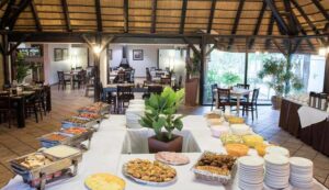
After your arrival at the Hosea Kutako International Airport approx. 45 km east of Windhoek, you will be welcomed by the car rental company and taken to Windhoek where you will take over your vehicle with all the necessary instructions and information. Afterwards you will drive to your accommodation where you are able to freshen up and rest. In the afternoon you will be picked up by your guide for an interesting Windhoek city tour, during which you will get to know historical buildings and the township of Katutura. In the evening you can go out for a relaxing dinner. We can recommend Joe’s Beerhouse, Cape Town Fish Market or The Stellenbosch.
Eingeschlossene Aktivitäten
• Historical visits
Optionale Aktivitäten
• You can visit Alte Feste an old fort and the 1896 Christuskirche Christ Church.
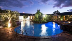
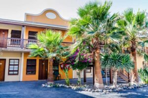
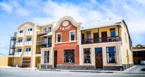
Über Nacht: Arebbusch Travel Lodge
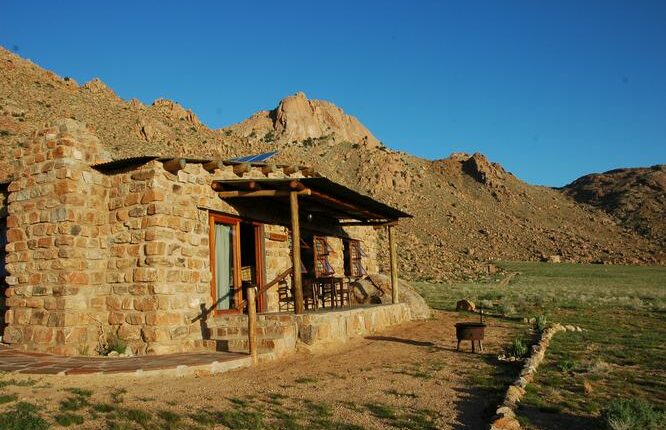
Omaruru is a small, historic town in the Erongo Region of central Namibia, lying roughly northeast of Wilhelmstal (about 75 km by road) along the C36/C33 route that leads toward central
and northern parts of the country. It sits on the banks of the usually dry Omaruru River and is
surrounded by semi-arid savanna and game-farm landscapes. The town enjoys more greenery
than the surrounding plains because of underground water reserves in the riverbed area.
Eingeschlossene Aktivitäten
• Afternoon game drive
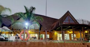
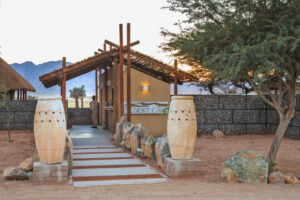
Über Nacht: Khan river Lodge


You will continue your journey and depart to Otjiwarongo an affluent town with a suburban feel and numerous attractions. The town is known for its excellent conservation projects, which include several parks protecting large wild cats
Eingeschlossene Aktivitäten
• A visit to the Cheetah Conservation Fund, and the Crocodile Ranch
Optionale Aktivitäten
• Hiking, guided nature walks, and safaris
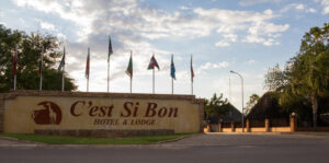
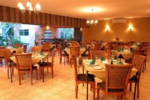
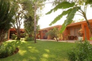
Über Nacht: C’est si Bon Hotel, Otjiwarongo
Sie fahren zum Etosha-Nationalpark und bleiben 2 Nächte. Das Hauptmerkmal des Parks ist eine Salzpfanne, die so groß ist, dass man sie vom Weltraum aus sehen kann. Dennoch gibt es eine große Anzahl von Wildtieren, die sich um die Wasserlöcher versammeln, so dass Sie fast garantiert Wildtiere sehen können. Gleichzeitig ist der Etoscha-Nationalpark eines der am leichtesten zugänglichen Wildreservate in Namibia und im südlichen Afrika, und die Konzentration von Großwild an den Wasserlöchern macht die Wildbeobachtung unglaublich lohnend. Vielleicht müssen Sie nicht einmal Ihr Camp verlassen, um Löwen, Elefanten, Nashörner und jede Menge Antilopen und Zebras zu sehen, die ihren Durst löschen.
Eingeschlossene Aktivitäten
Game drive
Overnight: Halali Resort


Die Kunden frühstücken, denn heute ist ein ganzer Tag der Safaripirsch, der viele Gelegenheiten für gute Sichtungen und spektakuläre Fotos bietet. Nach dem Frühstück in der Lodge begeben wir uns auf eine morgendliche Pirschfahrt.
Eingeschlossene Aktivitäten
Ganztägige Pirschfahrt
Über Nacht: Rechtsmittel
Have breakfast, leave the wilderness and wildlife of Etosha National Park behind us and depart to
Ruacana where you will be staying for 2 nights.
Eingeschlossene Aktivitäten
• Visit the Ruacana Falls
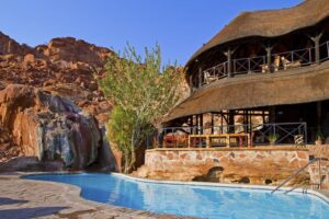
Über Nacht: Ruacana Eha Lodge
We will get up early and go on a hike to Ruacana Falls. The dramatic Ruacana Falls are 120m and 700m wide in full flood and are sometimes referred to as one of the most spectacular sights on the continent. After our hike to the falls, we start our expedition more in-depth into the Kunene Region, exploring the real life of the Himba Tribe.
Eingeschlossene Aktivitäten
Hiking
Overnight: Ruacana Eha Lodge
Basis
FB: Vollpension – Abendessen, Übernachtung, Frühstück und Mittagessen
Have an early breakfast and depart to Epupa Falls, today you have the day to enjoy the natural attractions around Epupa Falls
Eingeschlossene Aktivitäten
Guided Visit to a Himba Village, Sundowner drive/walk
Optionale Aktivitäten
Guided Hikes, white water rafting and kayaking and Bird Watching Trip by Boat
Overnight: Epupa Falls Lodge


Basis
FB: Vollpension – Abendessen, Übernachtung, Frühstück und Mittagessen
Die umliegende Landschaft ist durch niedrige Hügel und weite trockene Wüstenebenen gekennzeichnet, die von einer Vielzahl an die Wüste angepasster Wildtiere bewohnt werden. Die Stadt dient als zentraler Knotenpunkt der Himba-Kultur. Die Stadt ist ein idealer Ausgangspunkt für Besucher, die das Kaokoland erkunden und die Dörfer des wandernden Himba-Volkes besuchen möchten.
Eingeschlossene Aktivitäten
Visit Hoarusib River, Hiking
Optionale Aktivitäten
Visit the Ovahimba Living Museum
Overnight: Opuwo Country Lodge
Sie fahren nach Twyfelfontein, dem Weltkulturerbe mit den berühmten Felsgravuren, auf der Suche nach den schwer fassbaren, an die Wüste angepassten Elefanten. Je tiefer Sie ins Damaraland vordringen, desto dramatischer wird die Landschaft. Sie sollten Ihre Unterkunft erreichen. Genießen Sie einen weiteren atemberaubenden Sonnenuntergang mit einem erfrischenden Getränk.
Eingeschlossene Aktivitäten
See the Petrified Forest or marvel at the Organ Pipes and Vingerklip
Guided Hiking Trails.
Twyfelfontein rock engravings
Geological rock formations
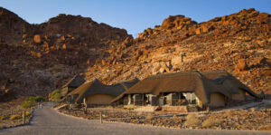
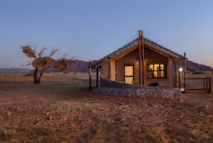
Übernachtung: Twyfelfontein Country Lodge
This morning we leave Twyfelfontein and make our way to the cooler coastal town of Swakopmund by the Atlantic Ocean. This town resembles a small German town with its architectural buildings, palm-lined streets, seaside promenades, restaurants, cafes, art galleries and museums. We spend the next 2 nights in Swakopmund enjoying the various different activities on offer.
Eingeschlossene Aktivitäten
2-Hour Quad Biking, Sand-Boarding
Übernachtung: Hotel Pension A La Mer
Today you have a free day to take on some of Swakopmunds activities, if you fancy something different, visit the local beaches, eat at the local restaurants and enjoy the town’s vibrant cafe culture.
Optionale Aktivitäten
Living Dunes Experience from Swakopmund; Scenic Desert Tour, Sky diving,
set horse riding and paragliding
Übernachtung: Hotel Pension A La Mer
Basis
FB: Vollpension – Abendessen, Übernachtung, Frühstück und Mittagessen
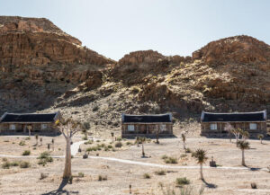
Leaving the coastal plateau, we head inland, via picturesque moon landscapes and rugged passes, pausing for a photo stop at the Tropic of Capricorn. Our accommodation for the night is under canvas in a picturesque setting, in a quaint desert camp, in the Khomas region of central Namibia.
Eingeschlossene Aktivitäten
Enjoy the sundowner Dune Drive
Übernachtung: Wüstencamp
Die Gäste wachen auf und frühstücken, bevor sie in den Park zur Sossuvlei-Exkursion aufbrechen, die die Dünen 45, Deadvlei, Hiddenvlei und Big Daddy umfasst. Der Reiseleiter wird regelmäßig anhalten, damit die Gäste Fotos machen und die Dünen sehen können.
Eingeschlossene Aktivitäten
Sossusvlei-Ausflug (Deadvlei, Big Daddy, Düne 45)
Übernachtung: Wüstencamp
Basis
FB: Vollpension – Abendessen, Übernachtung, Frühstück und Mittagessen
Today we drive through barren landscapes and Rocky Mountains dotted with quiver trees to one of Africas natural wonders, the Fish River Canyon. This wondrous canyon is the second largest canyon in Africa being 550m deep and 161km long. We enjoy an afternoon walk along the edges admiring the deep ravines and meandering waterways.
Eingeschlossene Aktivitäten
Hiking
Optionale Aktivitäten
Scenic chartered flights, nature drives and seasonal kayaking.
Overnight: Canyon Village
You will have breakfast and a full day to continue with the activities you did not get to do.
Overnight: Canyon Village
Über Nacht: Canyon Dorf
Basis
FB: Vollpension – Abendessen, Übernachtung, Frühstück und Mittagessen
Sie erhalten ein Frühstück und fahren nach Mariental, das in der Nähe des beeindruckenden Hardap-Damms liegt, dem größten Stausee Namibias. Das Hardap-Bewässerungssystem hat diesem trockenen Land Leben eingehaucht, das jetzt fruchtbares Ackerland mit Zitrusfrüchten, Melonen, Luzerne, Wein und Mais bietet und übersät ist mit Straußenfarmen.
Eingeschlossene Aktivitäten
Sunset Drive
Übernachtung: Bagatelle Kalahari Game Ranch

You will get breakfast and depart back to Windhoek